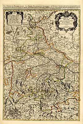
"Le Circle de Baviere" Map of Bavaria, from the 'Imperial Atlas' of Louis XIV, printed from 2 plates. Original outline colour. Copper engr., Amsterdam c1700, 84,5 x 56,7 cm. Very good impression and condition.
Back