|
Canada > St Lawrence River
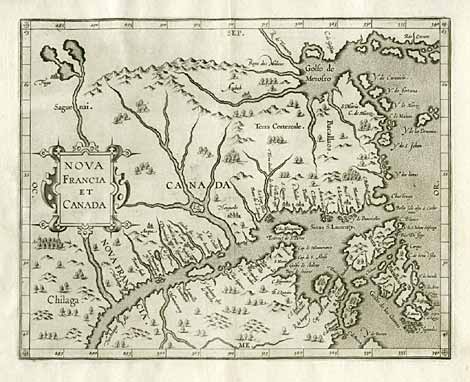
"Nova Francia et Canada"
Map of the estuary of the St Lawrence River and its surroundings. First
printed detail map of this region and first map with 'Canada' in the title.
From
the second edition of the atlas 'Descriptio Ptolemaicae Augmentum'.
Copper engr., Louvain 1597/1607, 23,5 x 29,5 cm.
Burden 102.
Neatly repaired tear at the left margin, not affecting the map.
€ 2.480,-
|