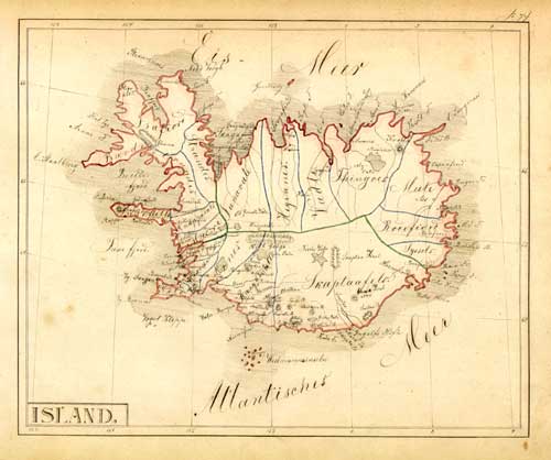
Iceland
"ISLAND"
from "Zeitungs-Atlas 2. Europa
außer Deutschland und
die übrigen Erdtheile."
A basic edition with 120 maps, 1849-52, and with the
handwritten title:
"Atlas über alle
bekannten Theile der Erde sowie über die wichtigste mathem. &
phys. Geographie von Herrmann J. Meyer Theil II. Hildburghausen
1852."
Manuscript,
drawn with brown ink, coastlines
and islands with red, county borders with blue and green watercolor.
21,5
x 26 cm, map no 74.
A
manuscript map of Iceland with much information
about the topography of the island, drawn between
1849 and 1852.
See
also under 'Old maps of America'
€ 3000,-
|