|
Northern Africa > Algeria, Tunisia
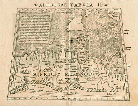
"Aphricae Tabula II"
Map of northern Africa with the area of Algeria
and Tunisia and with the Mediterranean Sea up
to Sicily. Picture of a sinking sailing ship
near the African coastline. At the upper left
a list with all the important towns of the countries
shown.
Woodcut by Sebastian Münster after
Claudius Ptolemy from 'Geographia Universalis
Vetus et Nova', published by D.H. Petri, Basle 1550, 32,5
x 26 cm.
450,-
|