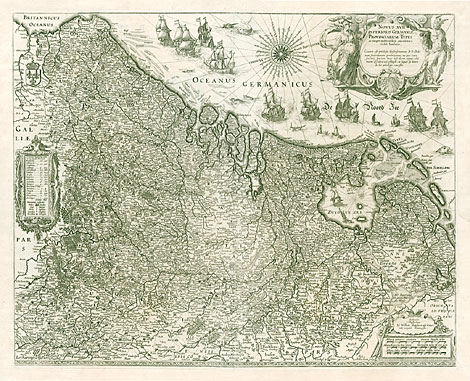
Map of the Netherlands.
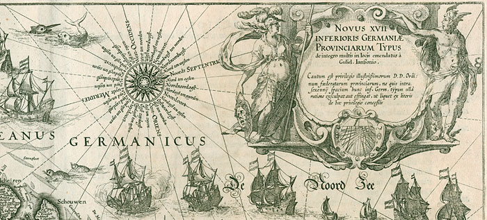
Title cartouche at upper right, beside
there is a wind rose with detailed descriptions
of the different directions. The North Sea is
decorated with many vessels and some sea monsters.
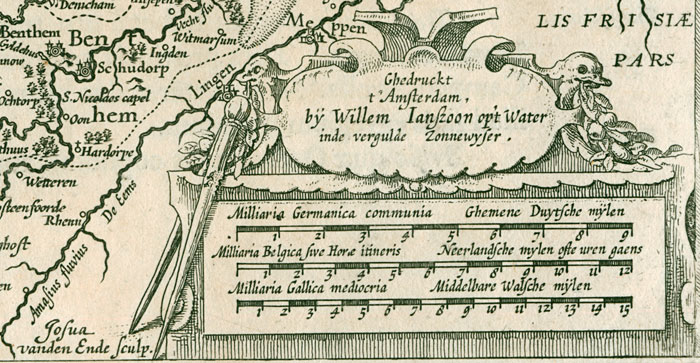
The cartouche at the lower right corner shows
three different scales, above are the publisher's
name and address, beside is the name of the
copper engraver.
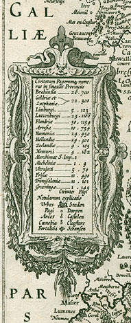
At the left side there is a
table with the number of the towns and villages
of each provinces shown at the map, followed
by a legend with the symbols used for towns,
villages, castles, monasteries and fortifications.
The map is quite similar - not only regarding
size and scale - to the map of the Netherlands
by Jan Baptista Vrients (see No LG 3766), published
1608 and 1612.
The number of towns and villages
in the tables vary a little bit as well as some
geographical details.
The engraver of the map,
Josua van den Ende (c1584-1634/38), worked for
Willem Janszoon mainly at the beginning of the
17th century.
|