|
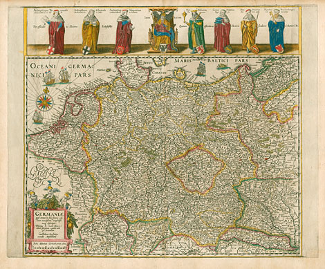
Germania
"Germaniae post omnes in hâc forma editiones
exactißima locupletißi maq descriptio. Ubicubq
B. Lector talem (*) viderit asteriscum cogitabit
inibi eße Academiam, Guilhelmus Ianßonius excudit
Amstelodami: "
Originally coloured copper engraving by Willem
Janszoon (Blaeu), Amsterdam 1607/09 - c1630,
43,5 x 53,5 cm. The date on the map has been
erased.
Very good and strong impression with a very
nice original coloration. Outer margins a little
bit brownish, lower right corner neatly repaired
- not affecting the map itself,
otherwise perfect condition.
2.800,-
|
|
Map of Germania with an illustration at the
upper margin, which shows the 7 electors - 3
ecclesiastical and 4 secular one - standing
at the left and right side of the king of the
Holy Roman Empire. At the right and left side
of the map are outlines with free space (?)
for more illustrations. A characterisitic feature
of the map - as already mentioned in the title
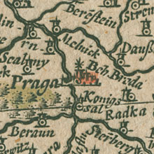
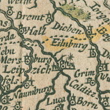
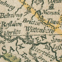
- is the marking of (nearly) all towns, which
have universities, e.g. Prague (1348), Vienna
(1365), Heidelberg (1386), Leipzig (1409), Wittenberg
(1502), Rostock (1519), Marburg (1527), Helmstedt
(1576, Academia Julia moved 1734 to Göttingen),
but Gießen (university founded 1607) is not
marked with an asterisks.
The map is the same as the first 'Typus-Blaeu'
maps at Meurer 2001, No 8.4.1.a, but without
the left and right borders with the views and
without the border with the coat of arms at
the lower margin.
"Die niederländischen Kartenmacher entwickelten
in der ersten Hälfte des 17. Jahrhunderts die
Ausschmückung der Karten mit dekorativen Randillustrationen
zu hoher Vollendung. Bildinformationen sollten
den topographischen Inhalt des Kartenbildes
ergänzen. Diese Karten erschienen in zahlreichen
Varianten mit wechselnder Zusammensetzung der
Bildelemente. Germania-Karten dieses Kartentyps
zeigen breite Rahmen mit Herrscherporträts,
Kostümfiguren, Wappen und vor allem Stadtansichten,
die sich zum besonders geschätzten Motiv herausbildeten.
Erste Beispiele sind die Karten von H. Hondius
1607 und von W. Jansz. Blaeu 1607/1609."
(L. Zögner: Imago Germaniae, 1996, S. 19).
Literature:
Meurer,
Peter H.: Mappae Germaniae, Die schönsten und
bedeutendsten Deutschlandkarten von 1482-1803.
Bad Neustadt a.d. Saale, Pfaehler 1984.
Meurer,
Peter H.: Corpus der älteren Germania-Karten.
Canaletto 2001.
Zögner,
Lothar: Imago Germaniae. Das Deutschlandbild
der Kartenmacher in fünf Jahrhunderten. Weißenhorn,
Anton H. Konrad 1996.
|