Gerard Mercator, Rumold Mercator
Gerard Mercator the
Younger, Michael Mercator
|
LH 0296
|
|
World and 4 continents
The famous maps of
the world and continents by the Mercator family
from one of the earliest editions by Jodocus
Hondius.
Amsterdam 1606.
Outstanding examples
of the art of map-making summing up the cartographic
knowledge in Europe during the Renaissance period.
25.800,-
|
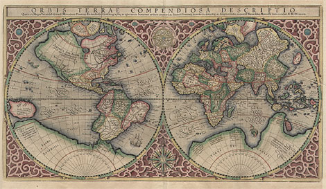
Map of the World:
"Orbis Terrae Compendiosa Descriptio
Quam ex Magna Universali Gerardi Mercatoris
... Rumoldus Mercator fieri curabat A°. M. D.
LXXXVII".
World in two hemishperes, surrounded by a
strapwork border. With an armillary sphere and
an elaborate compass rose between the two hemispheres.
Compiled by Rumold Mercator after Gerhard
Mercator's world map of 1569. First published
in an edition of Strabo's 'Geographia', Geneva
1587, and in an atlas by Mercator, Duisburg
1595.
From an early edition of a Mercator-Hondius
atlas, verso with Latin text.
Originally coloured copper engraving by Rumold
Mercator, published by Jodocus Hondius, Amsterdam
1606, 28,7 x 52 cm.
Very nice original colours. Paper with a
printer's crease, diagonally at the upper right
side, otherwise very good condition. Note the
differnet paper size of the maps of the continents.
Ref.: Shirley 157; Koeman Me15
|
| 
|
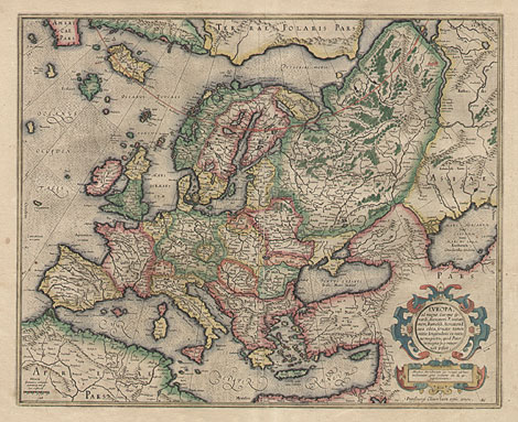
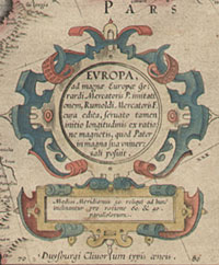
Europe:
"Europa, ad magnae Europae Gerardi Mercatoris
P. imitationem, Rumoldi Mercatoris F. cum edita
..."
Map of Europe with a nice and decorative
title cartouche. From an early edition of a
Mercator-Hondius atlas, verso with Latin text.
Originally coloured copper engraving by Rumold
Mercator, published by Jodocus Hondius, Amsterdam
1606, 38,5 x 47,2 cm.
Very nice original colours. Paper a little
bit peeled off at centrefold, otherwise very
good to perfect condition.
|
| 
|
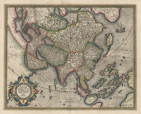
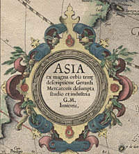
Asia:
"Asia ex magna orbis terrae descriptione
Gerardi Mercatoris desumpta, studio et industria
G.M. Iunioris."
Map of Asia with a nice and decorative title
cartouche. From an early edition of a Mercator-Hondius
atlas, verso with Latin text.
Originally coloured copper engraving by Gerard
Mercator the Younger, published by Jodocus Hondius,
Amsterdam 1606, 38 x 46,8 cm.
Very nice original colours and perfect condition.
|
| 
|
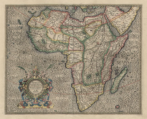
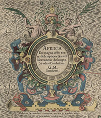
Africa:
"Africa. Ex magna orbis terrae descriptione
Gerardi Mercatoris desumpta. Studio & industria
G.M. Inunioris."
Map of Africa with a nice and decorative
title cartouche. From an early edition of a
Mercator-Hondius atlas, verso with Latin text.
Originally coloured copper engraving by Gerard
Mercator the Younger, published by Jodocus Hondius,
Amsterdam 1606, 38,3 x 47,3 cm.
Paper a little bit peeled off at centrefold
and with a small printer's crease at lower right
margin, otherwise perfect condition.
|
| 
|
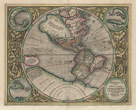
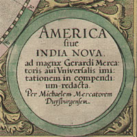
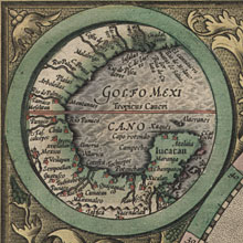
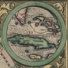
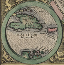
America:
"America sive India Nova, ad magnae
Gerardi Mercatoris avi Universalis imitationem
in compendium redacta. Per Michaelem Mercatorem
Duysburgensem."
Map of the western hemisphere with North
and South America, with 'Terra Australis' and
'Nova Guinea'. With three round inset maps (Haiti,
Cuba, and the Gulf of Mexico) and a title cartouche
at the corners. Maps are surrounded by ornamental
leaves and tendrils.
Originally coloured copper engraving by Michael
Mercator, published by Jodocus Hondius, Amsterdam
1606, 37,6 x 46,6 cm.
Very nice original colours and perfect condition.
Ref.: Burden 87
|
| 
|
Gerard Mercator (1512-1594)
|
| Cartographer,
mathematician and globemaker. Pupil of Gemma
Frisius in Louvian. From 1537 he worked as a
cartographer for his own. 1552 he moved to Duisburg.
There he made his most famous maps: 1554 the
map of Europe on 15 sheets, 1564 the map of
the British Isles on 8 sheets, and 1569 the
map of the World on 18 sheets, the first one
using Mercator's projection.
He planned to edit an extensive cosmography
starting at the beginning of the world, with
a description of the sky, the countries and
the sea, with a genealogy, a political history,
and a detailed chronology. Last one he already
published in 1569 and the first cartographic
part of his cosmography - a Ptolemy's Geographia
with 28 maps - appeared in 1578. From 1585 he
published an atlas with modern maps in five
parts. 1585 he issued the first three parts
with 51 maps, 1589 the fourth part with 22 maps,
and 1595 the fifth part was published
posthumously with 29 maps by his son Rumold
Mercator.
All 102 maps are signed in the plates 'Per
Gerardum Mercatorem'. The fifth part was completed
with a map of the world and maps of the 4 continents
which were made by Mercator's son Rumold
Mercator (c1545-1599, World and Europe) and
by his grandsons Gerard Mercator the Younger
(c1565-1656, Asia and Africa) and Michael Mercator
(c1567-c1600, America) which both were the sons
of Arnold Mercator (1537-1587), who engraved
together with his eldest son Johannes Mercator
(c1562-c1595) most of the maps of Ptolemy's
Geographia from 1578.
Jodocus Hondius (1563-1612) aquired the plates
for Mercator's atlases in 1604, which he extended
and re-published from 1606 - with a text by
his brother-in-law Petrus Montanus.
|
| Enlarged Pictures |
Back |
Kunstantiquariat Monika Schmidt Munich
Germany www.maps-n-views.com
|
|