|
Japan, Korea
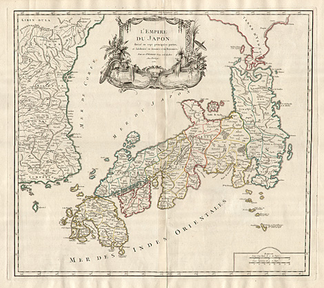
"L'Empire du Japon, divisé en sept principales
parties, et subdivisé en soixante et six Royaumes.
Par le S. Robert, Geog. ord. du Roi. Avec Privilege.
1750."
Map of Japan with the main island Honshu,
and with Shikoku and Kyushu in the South and
a part of Hokkaido in the North, and with Korea
at the left side. Above with a decorative title
cartouche with plants, ornaments and landscpae
pictures.
Copper engraving, original outline colours,
by Gilles Robert de Vaugondy (1686-1763), Paris
1750(d), 48 x 53,5 cm.
Nice and strong impression, perfect condition,
at the left and right side with wide margins.
Campbell 65, Walter 100.
1.300,-
|
Kunstantiquariat Monika Schmidt Munich
Germany www.maps-n-views.com
Antique Shop for Rare Old Prints: Old
Maps, Views, and Decorative Prints with
original
copper engravings, etchings, lithographs, steel engravings, woodcuts
|