Gerhard Mercator
|
LJ 2238
|
|
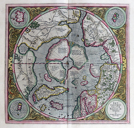
Map of the North Pole
"Septentrionalium Terrarum descriptio"
Orig. coloured copper engraving. From: 'Gerardi
Mercatorius et I(odoci) Hondii Atlas ou représentation
du monde universel ...' published by Henricus
Hondius, Amsterdam 1633, 37,5 x 39 cm.
First special map of the Arctic. Very nice
item in a perfect condition from a French edition.
4.300,-
|
| Map of the North Pole with three inset maps
of northern islands (Shetland, Faeroes, Frisland).
The map reflects the idea of a Northern Sea
Route to China and the Moluccan Islands. The
North Pole is shown as a black rock in the middle
of a sea, surrounded by a large country which
is divided by 4 rivers. To clarify the position
the northern parts of Europe, Asia and America
are shown additionally. Remaining free spaces
are filled with a few ornaments.
|
| Enlarged Picture |
Back |
Kunstantiquariat Monika Schmidt Munich
Germany www.maps-n-views.com
Antique Shop for Rare Old Prints: Old
Maps, Views, and Decorative Prints with
original
copper engravings, etchings, lithographs, steel engravings, woodcuts
|
|