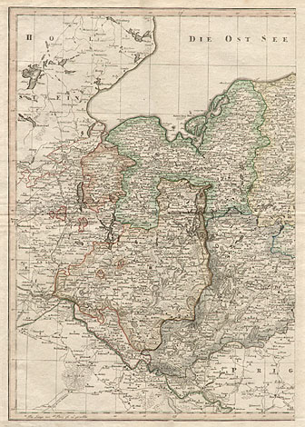
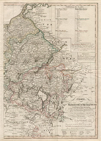
Mecklenburg
"Charte vom Großherzogthum Mecklenburg Schwerinischen
Antheils nach der neuen Eintheilung in sechs Districte,
nebst dem Fürstenthum Ratzeburg"
Large map of the duchy of Mecklenburg, from Lübeck
up to Neubrandenburg and from the Baltic Sea up
to the area of Prignitz. With a title cartouche
at lower right and explanations about regional destricts
and their towns at upper right.
Originally coloured copper engraving, printed
on two pages, made by Franz Ludwig Güssefeld, published
by Homann Heirs, Nuremberg 1812/13, after a map
of the Graf von Schmettau, printed with the privilege
for Christian Fembo 1813. Size: Each 61 x 44 cm,
total 61 x 88 cm.
Very good impression and condition.
810,-
|