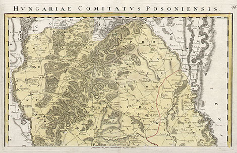
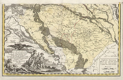
Western Slovakia, Bratislava
"Comitatus Posoniensis Germanis Presburg
dicti Delineatio Geographica ..."
Map of the count's land Pressburg (Posoniensis),
which was at that time an autonomous country within
the kingdom of Hungary. At lower left large decorative
title cartouche and a view of Bratislava with the
castle. Above the map is a one-line header "Hungariae
Comitatus Posoniensis", at lower right a legend
and scales.
Originally coloured copper engraving, printed
on two pages, after Joh. E. Alber, published by
Homann Heirs, Nuremberg 1757(d). Size: Each 35,5
x 56,5 cm, total 71 x 56,5 cm.
Perfect impression and condition.
790,-
|