|
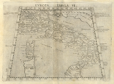
Ancient world, Roman Empire > Italy, Sicily,
Corsica, and Sardinia
"Tabula Europae VI."
Map of the Roman Empire with Italy and the
southern and western islands Sicily, Corsica,
and Sardinia. In the style of Ptolemy.
Etching from a Geography of Ptolemy edited
by Girolamo Ruscelli, printed and published
by Vincenzo Valgrisi, Venice 1561, 18,5 x 24,5
cm.
360,-
|