Girolamo Ruscelli - Vincenzo Valgrisi

LN 1648

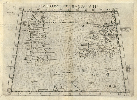
Ancient world, Roman Empire > Sicily, Sardinia, and Malta

"Tabula Europae VII."

Map with the islands Sicily, Sardinia, and Malta (Melite). In the style of Ptolemy.

Etching from a Geography of Ptolemy edited by Girolamo Ruscelli, printed and published by Vincenzo Valgrisi, Venice 1561, 19 x 25 cm.

€ 290,-

Maps by Italian mapmakers of the 16th century are worked out very fine and are famous for their elegant design. Remained copies are quite rare. Zögner, Imago Germaniae, p 14.

Enlarged Picture

Back

Kunstantiquariat Monika Schmidt • Munich • Germany • www.maps-n-views.com