|
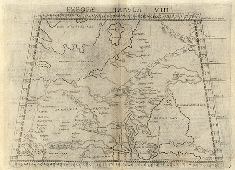
Eastern Europe > Sarmatia, European part
between the Vistula and Don River, the Baltic
and Black Sea
"Tabula Europae VIII."
Map of the European part of Sarmatia the
Vistula and Don River, the Baltic and Black
Sea (Sea of Azov), with regions of the countries
of Poland, Hungary, Romania, Ukraine, Belorussia,
and Russia.
Etching from a Geography of Ptolemy edited
by Girolamo Ruscelli, printed and published
by Vincenzo Valgrisi, Venice 1561, 19 x 25 cm.
250,-
|