|
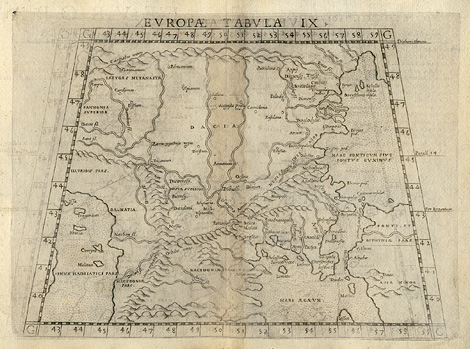
Southeast Europe > Dacia, Europe between
the Adriatic and the Black Sea
"Tabula Europae IX."
Map of Dalmatia, Pannonia and Dacia between
the Adriatic and the Black Sea, the Northern
Carpathian Mountains and Macedonia, with the
areas of the countries Croatia, Slovenia, Bosnia
and Herzegowina, Serbia, Hungary, Romania, and
Bulgaria. In the style of Ptolemy.
Etching from a Geography of Ptolemy edited
by Girolamo Ruscelli, printed and published
by Vincenzo Valgrisi, Venice 1561, 19 x 25 cm.
250,-
|