|
West Africa > between the Mediterranean
Sea, Atlantic Ocean and the Gulf of Guinea
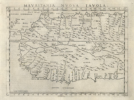
"Mauritania Nuova Tavola."
Map of Western Africa between the Mediterranean
Sea, the Atlantic Ocean and the Gulf of Guinea.
With Madeira and the Canary Island, and with
the area of the former kingdom of Mauretania.
Etching from a Geography of Ptolemy edited
by Girolamo Ruscelli, printed and published
by Vincenzo Valgrisi, Venice 1561, 18,5 x 24,5
cm.
250,-
|