|
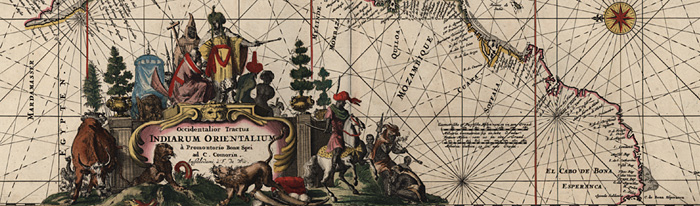
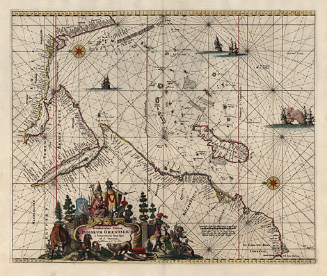
Indian Ocean, chart
"Occidentalior Tractus Indiarum Orientalium"
Chart of the northwestern Indian Ocean with
the eastern coast of Africa (with Madagascar),
the Arabian Peninsla, and the western coast
of India, orientated to the east. With a decorative
cartouche at the lower part.
Orig. coloured copper engraving by Frederick
de Wit, from 'Orbis Maritimus ofter Zee Atlas',
Amsterdam c1675, 44 x 53 cm.
Perfect impression, colours and condition.
sold
|
Kunstantiquariat Monika Schmidt Munich
Germany www.maps-n-views.com
Antique Shop for Rare Old Prints: Old
Maps, Views, and Decorative Prints with
original
copper engravings, etchings, lithographs, steel engravings, woodcuts
|