A. Ortelius / J.B. Vrients
|
LO 2088
|
|
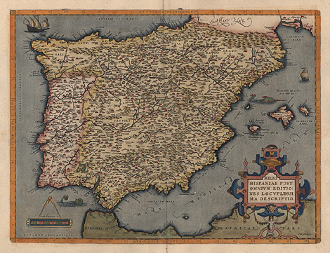
Iberian Peninsula
Spain, Portugal
"Regni Hispaniae post omnium editiones
locupletissima descriptio"
Map of the Iberian Peninsula, with the Balearic
Islands. Cartouche at lower right.
Perfect impression, colours and condition.
Ref.: van den Broecke No 25 - 1612L16
950,-
|
|
Orig. coloured copper engraving by Abraham
Ortelius, from "Typus Orbis Terrarum"
published by Jan Baptista Vrients, Antwerpen
1612, Latin edition, 38 x 49,8 cm.
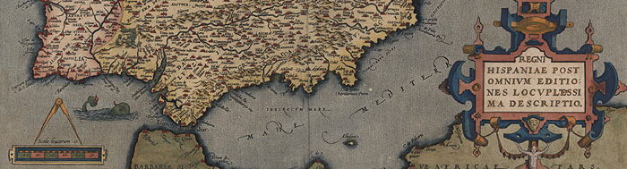
Some details of the map:
|
|
|
|
Abraham Ortelius (1527-1598). Cartographer
and publisher in Antwerp. 1570 he started to
publish the first modern atlas, 'Theatrum Orbis
Terrarum', with maps in a uniform size. The
atlas was issued, revised and enlarged, in many
editions and several languages until 1612.
Jan Bapatista Vrients (1552 - 1612). Engraver,
publisher and mapseller of Antwerp, who acquired
about 1600 stock and plates of Ortelius and
de Jode. At the beginning of the 17th century
he published some issues of Ortelius' atlas
"Theatrum Orbis Terrarum", completed
with some of his own maps.
|
| Enlarged Picture |
Back |
Kunstantiquariat Monika Schmidt Munich
Germany www.maps-n-views.com
Antique Shop for Rare Old Prints: Old
Maps, Views, and Decorative Prints with
original
copper engravings, etchings, lithographs, steel engravings, woodcuts
|
|