Laurent Fries, Claudius Ptolemy
|
LO 2388
|
|
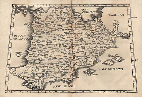
Iberian Peninsula
Spain, Portugal
"Europae Tabula secunda continet Hispaniam"
Map of the Iberian Peninsula.
Woodcut by Laurent Fries, after Martin Waldseemüller,
in the style of Ptolemy, Vienne 1535, 31 x 44,5
cm.
Esp. at upper margin somewhat water-stained,
otherwise very good impression and condition.
800,-
|
|
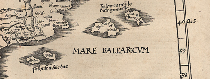
Some details of the map:
|
|
|
|
Laurent Fries (c1490 1532): Physicist,
astrologer and geographer in Metz and Strasbourg.
Editor of Ptolemaic and revised Waldseemüller
maps, published in Lyon, Vienne, and Strasbourg.
Martin Waldseemüller (1470 c1518): Cartographer
from Lorraine. Made two maps of the world, one
of Europe and maps for a Ptolemaic Geography,
published by Schott in Strasbourg 1513.
Claudius Ptolemy (87 150): Astronomer and
geographer in Alexandria. About 100 AD he wrote
a description how to make maps. From the 12th/13th
century onwards a 'Geography' was developed
from his manuscript and under his name. The
first printed edition with maps was published
in Bologna 1477.
|
| Enlarged Picture |
Back |
Kunstantiquariat Monika Schmidt Munich
Germany www.maps-n-views.com
Antique Shop for Rare Old Prints: Old
Maps, Views, and Decorative Prints with
original
copper engravings, etchings, lithographs, steel engravings, woodcuts
|
|