|
Eastern coast of the United States
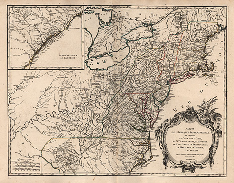
"Partie de l'Amerique Septentrionale,
qui comprend le Cours de l'Ohio ... la Caronline.
Avec Privilege 1755."
Map of the eastern coast of the United States
from the area of Maine down to North Carolina,
with an inset map with the coast down to Florida,
decorative title cartouche at lower right.
Copper engraving, original outline colours,
by Gilles Robert de Vaugondy and M.C. Haussard,
from 'Atlas Universel', Paris 1757, 48 x 62
cm.
Perfect impression and condition.
1.100,-
|
Kunstantiquariat Monika Schmidt Munich
Germany www.maps-n-views.com
Antique Shop for Rare Old Prints: Old
Maps, Views, and Decorative Prints with
original
copper engravings, etchings, lithographs, steel engravings, woodcuts
|