|
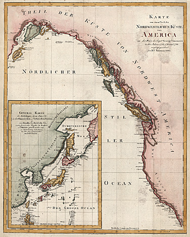
Northwestern coast of North America
"Karte von einem Theil der Nordwestlichen
Küste von America zu der Reise des Capit George
Vancouver in den Jahren 1792, 1793 und 1794
verjüngt gezeichnet von D.F. Sotzmann 1800."
Map of the Northwestern coast of North America,
with California, Canada, Alaska. With an inset
map Northwestern Pacific Ocean with the northern
Philippines, Japan, Sachalin, the Kuril Islands
and the Kamchatka Peninsula.
Coloured copper engraving after D.F. Sotzmann,
engraved by Ferd. Sprögel, Berlin 1800, 51 x
40,2 cm.
Paper somewhat stained, otherwise very good
impression and condition.
600,-
|
Kunstantiquariat Monika Schmidt Munich
Germany www.maps-n-views.com
Antique Shop for Rare Old Prints: Old
Maps, Views, and Decorative Prints with
original
copper engravings, etchings, lithographs, steel engravings, woodcuts
|