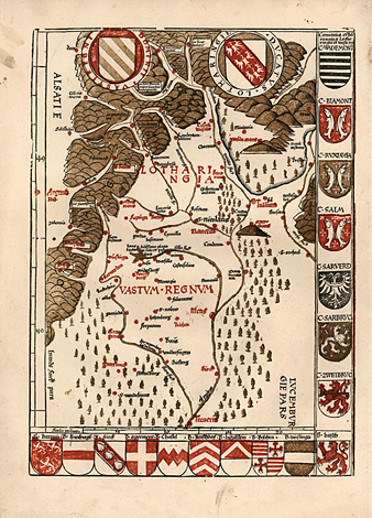
Saarland - Lorraine
"Ducatus Lothringie"
Map of Lorraine, orientated to the south.
It shows the area of the rivers Moselle and
Saar (Sarre), from Trier to Nancy and Toul up
to the Vosges. At the right and lower part columns
with the coat of arms of this region.
Woodcut by Martin Waldseemüller, printed
in colours, 'modern' map from the 'Geographia',
Strasbourg 1513, 36 x 26 cm.
First woodcut map by Martin Waldseemüller
printed in colours, rare.
Perfect impression and condition, strong
paper.
sold
|