Jacques Nicolas
Bellin (1703-1773)
|
LV 04811
|
|
U.S.A. - Louisiana, Florida
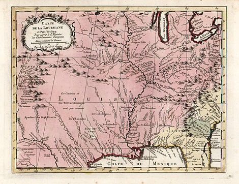
Carte de la Louisiane et Pays Voisins. Pour
servir à l'Histoire des Etablissemens Europeens.
Par M.B. Ing. de la Marine.
Orig. coloured copper engraving by Jacques Nicolas
Bellin (1703-1773), Paris 1767, 21,5 x 29,5.
Very good impression and condition.
450,-
|
| Map of the area of the former French Colonies.
Louisiana, the northern parts of Texas and Florida,
regions of Georgia and Carolina. With the names
of the Indian tribes, who lived in the area between
the Rio Bravo (Rio Grande) and Mississippi rivers.
|
| Enlarged Picture |
Back |
Kunstantiquariat Monika Schmidt Munich
Germany www.maps-n-views.com
Antique Shop for Rare Old Prints: Old
Maps, Views, and Decorative Prints with
original
copper engravings, etchings, lithographs, steel engravings, woodcuts
|
|