|
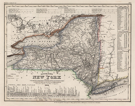
New York
Neueste Karte von New York mit seinen Canaelen,
Strassen, Eisenbahnen, Entfernungen der Hauptpunkte und Routen für Dampfschiffe.
Nach den besten Quellen verbessert. 1844.
Map of the State of New York, from Long Island
to Lake Ontario, at lower left with a profile of
the Erie Canal.
Steel engraving, original outline colour, from
Meyer's-Handatlas, published by 'Bibliographisches
Institut' Hildburghausen, Amsterdam, Paris and Philadelphia,
about 1846, 30 x 37 cm.
Very good impression and condition.
180,-
|
Kunstantiquariat Monika Schmidt Munich
Germany www.maps-n-views.com
Antique Shop for Rare Old Prints: Old
Maps, Views, and Decorative Prints with
original
copper engravings, etchings, lithographs, steel engravings, woodcuts
|