|
Pennsylvania
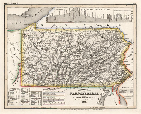
Neueste Karte von Pennsylvania mit seinen Canaelen,
Eisenbahnen & c. Nach den besten Quellen bearbeitet. 1845.
Map of the State of Pennsylvania, from Delaware
river to Lake Erie, with a profile of the Pennsylenia
Canal.
Steel engraving, original outline colour, from
Meyer's-Handatlas, published by 'Bibliographisches
Institut' Hildburghausen, Amsterdam, Paris and Philadelphia,
about 1846, 30 x 37 cm.
Very good impression and condition.
100,-
|
Kunstantiquariat Monika Schmidt Munich
Germany www.maps-n-views.com
Antique Shop for Rare Old Prints: Old
Maps, Views, and Decorative Prints with
original
copper engravings, etchings, lithographs, steel engravings, woodcuts
|