|
|
|
|
In our bookshop we offer
you a selection of specialist
books on:
Old views and maps, decorative
prints and their
artists, map and globe makers, engravers,
publishers, naturalists etc.
|
|

|
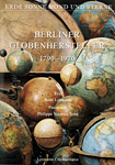
BERLINER GLOBENHERSTELLER
1790 - 1970
Text René
Lehmann / Fotografie Philippe
Valentin Senn
Lehmanns
Colonialwaren, 1st edition 2010,
self-published.
Over 200 images mainly
in color, showing terrestrial
and celestial globes in
different versions and settings.
With historic advertisements
and original informations
of producers and manufacturers,
this unique book illustrates
the innovative and changeable
history of globe manufacturers
in Berlin from 1790 until
1970 in Germany.
THE BOOK CONTAINS ENGLISH
TRANSLATIONS OF ALL CHAPTERS
!
120 pages, more
than 200 images, 30,2 x 21,6
cm. Hardcover.
New items.
In
German and English.
Order number: P0211
€ 49,90
|
|
|

Kunstantiquariat Monika
Schmidt
Augsburger
Vedutenstecher und -verleger.
Katalog zur Ausstellung,
Schloss Haimhausen, 1982.
Catalogue about
engravers and publishers
who lived and worked in
Augsburg during the 17th
and 18th century. With the
biographies and many works
of art of Stridbeck,
Bodenehr, Wolff, Leopold,
Werner, Probst and Engelbrecht.
66 pages with many
illustrations, 21 x 28,5
cm.
Paperback,
as new, in German.
Order number: P2097
€ 15,-
|
|
|

Diefenbacher/Heinz/Bach/Bach-Damaskinos
(editors)
"auserlesene
und allerneueste Landkarten".
Der
Verlag Homann in Nürnberg
1702-1848.
Stadtarchiv
Nürnberg. Stadtmuseum
Fembohaus. Nuremberg
2002.
A comprehensive history
about one of the most important
publishing houses of maps
and views in the 18th and
19th century.
275 pages with 107 colour
and black-and-white illustrations, 23 x 24 cm.
Brand
New. Hardcover. In German.
Order number: P0337
€ 30,-
|
|
|

Wilfrid Blunt (Autor)
und William T. Stearn (editor)
The
Art of Botanical Illustration.
New Edition revised and
enlarged.
Antique Collectors
Club Ltd. in association
with the Royal Botanic Gardens,
Kew Gardens, 1994.
New edition of the classic
work on the history
and development of botanical
illustrations during the
centuries, first published 1950. Revised
by Prof. Stearn, botanist
formerly
with the Britisch Museum.
It includes twice as many
color plates as the long
out-of-print 1950 edition.
368 pages with many illustrations, 27,4 x 21,8
cm. Hardcover binding with
the original fine dust jacket.
Excellent condition, as
new.
Order number: P1037
€ 110,-
|
|
|
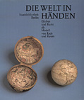
Staatsbibliothek Berlin
Die
Welt in Händen. Globus
und Karte als Modell von
Erde und Raum.
Ausstellungskatalog
bearbeitet von Lothar Zögner,
Nov. 1989 - Jan. 1990.
Staatsbibliothek
Preußischer Kulturbesitz,
Berlin, 1989.
Catalogue of a joint
exhibition on old globes
and maps organized by the
'Staatsbibliothek Preußischer
Kulturbesitz', Berlin, together
with the International
'Coronelli-Gesellschaft für
Globen- und Instrumentenkunde',
Vienna; with contributions
by Lothar Zögner,
Rudolf Schmidt, Franz Adrian
Dreier, Gudrun Zögner,
Franz Wawrik, Klaus Lindner,
Johannes Dörflinger,
and Heide Wohlschläger.
148 pages with 121 figures
and 24 plates, 27 x 23 cm.
Paperback,
as new, in German.
Order number: P0837
€ 30,-
|
|
|
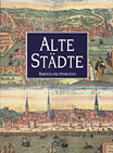
John Goss
Alte Städte.
Karten und Ansichten.
Kommentiert
und mit einer Einleitung
versehen von John Goss.
Paul
Neff Verlag KG, Wien, 1991.
60 large-sized reproductions
of the best views from 'Civitates
orbis terrarum' by Georg
Braun and Frans Hogenberg.
128 pages with 60 double-paged
colour-plates, 39 x 29 cm.
Hardcover binding with the
original fine dust jacket.
Excellent condition, as
new. German edition.
Order number: P0937
€ 48,-
|
|
|
Bayerische Staatsbibliothek
Die
Karte als Kunstwerk. Dekorative
Landkarten aus Mittelalter
und Neuzeit.
Ausstellungskatalog
bearbeitet von Traudl Seifert,
Sept.-Nov. 1979.
Verlag
Dr. Alfons Uhl, Unterschneidheim,
1979.
Catalogue of an exhibition
of old maps from the medieval
manuscript maps to the copper
engravings of the 18th century.
160 pages with many black-and-white
illustrations, 35
x 25,5 cm.
Paperback. Cover
a little bit soiled, otherwise
as new. In German.
Order number: P0637
€ 32,-
|
|
|
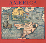
Bayerische Staatsbibliothek
Amerika.
Das frühe Bild der
Neuen Welt.
Ausstellungskatalog
bearbeitet von Hans Wolff,
April - Juni 1992.
Prestel-Verlag,
Munich, 1992.
Catalogue of a special
exhibition in Munich about
the discovery of America
500 years ago, with contributions
by Franz
Georg Kaltwasser, Hans Wolff,
Hans-Joachim König,
Uta Lindgren, Rüdiger
Finsterwalder, and Susi Colin.
192 pages with many illustrations, 27,5 x 29 cm.
Paperback,
as new, in German.
Order number: P0737
sold
|
|
|
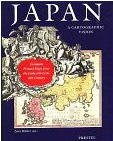
Lutz Walter (editor)
Japan.
A Cartographic Vision. European
Printed Maps from the Early
16th to the 19th Century.
Munich Prestel-Verlag 1994.
A history of the cartography
of Japan seen from the point
of view of famous European
navigators and cartographers
as Marco Polo,
Engelbert Kaempfer, or Franz von Siebold.
Revised and enlarged
edition of the catalogue
of an exhibition commemorating
the 120th anniversary of
the ' Deutsche Gesellschaft
für Natur und Völkerkunde
Ostasiens (OAG)'. With 11
essays by Walter, Eberhard
Friese, Roderick M.Barron,
Ulrich Pauly, Wolfgang Michel,
Jason C.Hubbard, Josef Kreiner,
and Adriana Boscaro.
232 pages, 265 illustrations
with 182 maps or details,
31 x 24 cm.
Soft cover.
English edition. In as new
condition, originally packed.
Order number: P0137
€ 50,-
|
|
|
Glen McLaughlin with
Nancy H. Mayo
The Mapping
of California as an Island:
An Illustrated Checklist.
The
California Map Society,
1995. Occasional paper No
5. First edition.
Califorina seen as an
island on maps esp. of the
16th and 17th century.
134 pages with many
illustrations. Soft cover.
Excellent condition, as
new.
Order number: P0537
€ 85,-
|
|
|
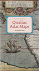
M.P.R. van den Broecke
Ortelius
Atlas Maps. An illustrated
Guide.
Westrenen, HES
Publishers BV, Utrecht,
1996.
Reference book which
provides information on
the occurrence of each map
in the various atlas editions
by Abraham Ortelius.
It allows the map collector
to determine from which
edition his maps by Ortelius
derived. Each map is illustrated,
described in detail and
with information on the
various states that most
maps went through. With
a biography on Ortelius
and a histroy of his atlases.
308 pages, with 234 maps
described,
24,5 x 13,5 cm.
Hardcover,
in as new condition.
Order number: P0237
€ 85,-
|
|
|
M. van den Broecke,
P. van der Krogt and P.
Meurer (editors)
Abraham
Ortelius and the First Atlas.
Essays Commemorating the
Quadricentennial of his
Death. 1598-1998. With an
Introduction by Leon Voet,
Honorary Curator of the
Plantin Moretus Museum in
Antwerp.
Utrecht, HES
Publishers, 1998.
Comprehensive information
on the life and work of Abraham
Ortelius, Contents include: "Abraham
Ortelius and his World"’
"The Theatrum Orbis
Terrarum: The First Atlas?";
"The Wall Maps by Abraham
Ortelius"; "Ortelius
as the Father of Historical
Cartography"; "The
World Maps in the Theatrum";
"The Americas Revealed
in the Theatrum".
431 pages with many
illustrations. Hardcover
binding,
30,5 x 24,5cm.
Excellent condition, as
new.
Order number: P0437
€ 150,-
|
|
|
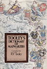
R. V. Tooley
Tooley's
Dictionary of Mapmakers
Compiled
by Ronald Vere Tooley. With
a preface by Helen Wallis.
Map
Collector Publications Limited,
Tring, Hertfordshire, England,
1979.
The dictionary provides
information on about 20 000 cartographers,
engravers, and publishers
active from earliest times
until 1900, it is a unique
source of information about
major as well as lesser-known
mapmakers from all parts
of the world, and it was
compiled by one of the best
experts in the history of
cartography of the 20th
century.
696 pages, 91 illustrations,
26,2 x 18,2 cm. Hardcover.
A
collector's item of the
first edition - originally
packed.
Order number: P1137
€ 320,-
|
|
|
R. V. Tooley (editor)
The
Map Collector
Quarterly
journal since 1978
Map
Collector Publications Limited,
Tring, Hertfordshire, England,
1978 - 1996.
An English magazine for
collectors of old maps. Each
issue has about 70 pages with
much information on the
history of maps and mapmaking.
Some of the back issues
we can still offer you:
No 19 €
70,-
No 21 €
55,-
No 22 €
30,-
No 24 €
40,-
No 33, 35, 37, 38,
39, 50, 51, 52, 54 €
30,-
No 55 €
40,-
No 56, 57, 59, 64,
66 € 20,-
No 70, 72, 73 €
30,-
|
|
|
|
Back
to Top
|
|
|


