WSM 05413
Sothern Europe - Italy, Corsica
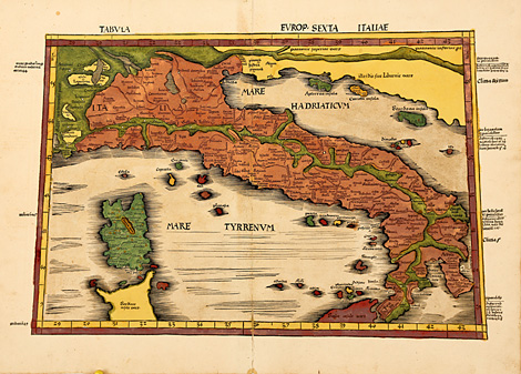
Tabula Europ. Sexta Italiae.
Map of Italy with Corsica, parts of Sardinia
and Sicily, the Tyrrhenian and Adriatic Sea.
Trapeze-shaped in the style of Ptolemy.
Originally coloured woodcut map from Ptolemy's
Geographia by Martin Waldseemüller, published
by Jakob Äschler and Georg Übelin, printed by
Johannes Schott, Straßburg 1513, 36,5 x ca.
53,5 cm (map size).
Perfect condition, wide margins, splendid
original colours.
sold
|
Kunstantiquariat Monika Schmidt Munich
Germany www.maps-n-views.com
Antique Shop for Rare Old Prints: Old
Maps, Views, and Decorative Prints with
original
copper engravings, etchings, lithographs, steel engravings, woodcuts
|