WSM 08413
Near East - Israel, Palestine, West Bank
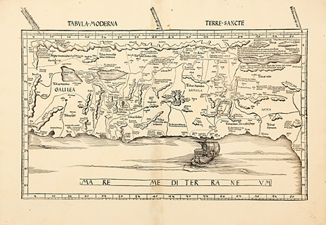
Tabula Moderna Terre Sancte
Detailed and 'modern' map of the Holy Land
(Terra Sancta), seen from the Mediterranean
Sea to the East.
Woodcut map from the supplement of the Geographia
by Martin Waldseemüller, published by Jakob
Äschler and Georg Übelin, printed by Johannes
Schott, Strasbourg 1513, 33,5 x 56 cm (size
of the map).
Perfect condition, wide margins.
7.000,-
|
Kunstantiquariat Monika Schmidt Munich
Germany www.maps-n-views.com
Antique Shop for Rare Old Prints: Old
Maps, Views, and Decorative Prints with
original
copper engravings, etchings, lithographs, steel engravings, woodcuts
|