WSM 09413
Near East
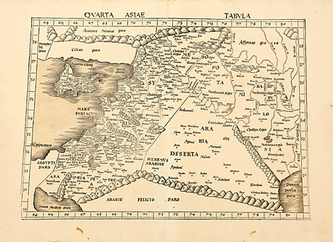
Quarta Asiae Tabula.
Map of the Near East between the Mediterranean
Sea and the Persian Gulf, with Cyprus and the
regions of Israel, Palestine, the Lebanon, Jordania,
Syria and Iraq. Trapeze-shaped in the style
of Ptolemy.
Woodcut map from Ptolemy's Geographia by
Martin Waldseemüller, published by Jakob Äschler
and Georg Übelin, printed by Johannes Schott,
Straßburg 1513, 37,5 x 50-53,5 cm (map size).
A few small spots, mainly at outer margins,
otherwise very good condition, wide margins.
5.800,-
|
Kunstantiquariat Monika Schmidt Munich
Germany www.maps-n-views.com
Antique Shop for Rare Old Prints: Old
Maps, Views, and Decorative Prints with
original
copper engravings, etchings, lithographs, steel engravings, woodcuts
|