|
|
|
Home
Old
maps by
G. Mercator
|
|
|
|
|
Celebrating
the 500th anniversary
of Gerardus Mercator's
birth
Gerardus Mercator
(1512 1594)
|
Cartographer,
mathematician
and globemaker.
Pupil of Gemma
Frisius in Louvian.
From 1537 he
worked as a
cartographer
for his own.
1552 he moved
to Duisburg.
There he made
his most famous
maps: 1554 the
map of Europe
on 15 sheets,
1564 the map
of the British
Isles on 8 sheets,
and 1569 the
map of the World
on 18 sheets,
the first one
using Mercator's
projection.
He planned
to edit an extensive
cosmography
starting at
the beginning
of the world,
with a description
of the sky,
the countries
and the sea,
with a genealogy,
a political
history, and
a detailed chronology.
Last one he
already published
in 1569 and
the first cartographic
part of his
cosmography
- a Ptolemy's
Geographia with
28 maps - appeared
in 1578. From
1585 he published
an atlas with
modern maps
in five parts.
1585 he issued
the first three
parts with 51
maps, 1589 the
fourth part
with 22 maps,
and 1595 the
fifth part was
published posthumously
with 29 maps
by his son Rumold
Mercator.
All 102 maps
are signed in
the plates 'Per
Gerardum Mercatorem'.
The fifth part
was completed
with a map of
the world and
maps of the
4 continents
which were made
by Mercator's
son Rumold
Mercator (c1545-1599,
World and Europe)
and by his grandsons
Gerard Mercator
the Younger
(c1565-1656,
Asia and Africa)
and Michael
Mercator (c1567-c1600,
America) which
both were the
sons of Arnold
Mercator (1537-1587),
who engraved
together with
his eldest son
Johannes Mercator
(c1562-c1595)
most of the
maps of Ptolemy's
Geographia from
1578.
Jodocus Hondius
(1563-1612)
aquired the
plates for Mercator's
atlases in 1604,
which he extended
and re-published
from 1606 -
with a text
by his brother-in-law
Petrus Montanus.
About
500 Years Mercator
see also the website
of the IMCoS Symposium 2012 in Vienna
under www.mercator-500.at
|
| Please,
click on a picture
for more information.
|

Mercator
was planning
to write a Cosmography
describing Creation,
Heaven and Earth,
Genealogy and
the History of the
World in five
parts. First
ideas about
this work we
find in
the introduction
of his Chronologia,
published in
1569:
A) The creation
of the world,
published posthumous
as introduction
of his Atlas
from 1595
B)
Astronomy: Description
of the heaven,
not published
C)
Cartography:
Mapping of the
World in three
parts:
-
A modern geography,
published as
Atlas in five
parts from 1585
-
A Ptolemy's
Geography with
28 maps, published
in 1578.
-
An ancient geography,
not published
D)
Genealogy and
History of the
World, published
as text to his
maps in the
atlas
E)
Chronologia,
published in
1569
In 1578 the
Ptolemy's Geography
was published
as the first
part of the
Cartography
of Mercator's
Cosmography
with 28 maps.
Title: "Tabulae
Geographicae
Cl. Ptolemei
ad mentem autoris
restitutae &
emendatae. Per
Gerardum Mercatorem
... Coloniae
Agrippinae Typis
Godefridi Kempensis.
Anno Virginei
Partus, MDLXXVIII."
The following
offered 18 maps
are from the
first edition
of this Ptolemy's
Geography by
Gerhard Mercator,
printed and
published by
Godfried Kempen
(Godefridi Kempensis),
Cologne 1578.
All offered
maps have a
very nice original
colouring, most
of them have
broad margins
and they are
- if not mentioned
otherwise -
in very good
to perfect condition,
wide margins
partly a little
bit stained.
Gerardus
Mercator after
Claudius Ptolemy,
1st edition 1578:
|
| 
|
|
|
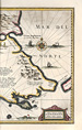
France
|
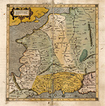
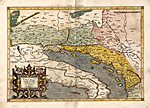
Alps - Adria
- Italy
|
|
|
|
| 
|
|
|
Italy with
Corsica
|
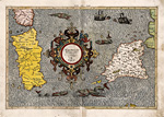
Sardinia
and Sicily
|
|
|
|
| 
|

|
|
The Balkans
|
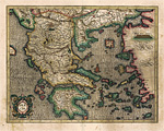
Greece and
the Aegean Sea
|
|
|
|
| 
|
|
|
Northern
Africa, region
of Libya
|
Northern
Africa
|
|
|
|
| 
|

|
|
Turkey and
Cyprus
|
Sarmatia
|
|
|
|
| 
|

|
|
The Caucasus
area
|
Near East
|
|
|
|
| 
|

|
|
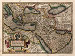
Middle East
- Persia
|
Arabian Peninsula
|
|
|
|
| 
|

|
|
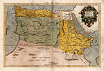
Persia, Afghanistan,
Pakistan
|
India
|
|
|
|
| 
|

|
|
Mainland
Southeast Asia
|
Taprobana,
Ceylon
|
|
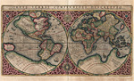
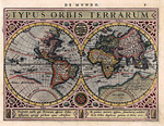
Maps
of the World
and 4 continents:
Jodocus Hondius
after Gerardus
Mercator, Amsterdam
1607
|
|
|
|
|
World
|
Europe
|
|
|
|
|
|

|
|
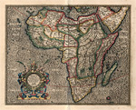
Africa
|
America
|
|
|
|
|
|
|
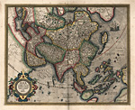
Asia
|
|
In the following
we offer you
some maps from
a Mercator-Hondius
Atlas from 1616.
Title: Gerhardi
Mercatoris Atlas
sive Cosmographiae
Meditationis
de Fabrica Mundi
et Fabricati
Figura Denuò
auctus Editio
Quarta. Sumptibus
& typis
aenais Judoci
Hondij, Amsterodami
An. D. 1616.
All offered
maps have a
very nice original
colouring and
are - if not
mentioned otherwise
- in very
good condition.
|
| 
|
|
| Rügen
|
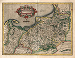
Prussia
|
|
|
|
| 
|
|
|
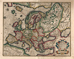
Greece and
the Aegean Sea
|
Ottoman Empire
|
|
In the following
we offer you
some maps from
a later Mercator-Hondius
Atlas, published
by Henricus
Hondius in 1633,
verso with French
text.
Title: Gerhardi
Mercatoris et
I. Hondii Atlas
ou Representation
du Monde Universel
...
All offered
maps have a
very nice original
colouring and
are - if not
mentioned otherwise
- in very
good condition.
|
| 
|
|
|
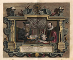
Gerhard Mercator
and Jodocus
Hondius
|
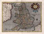
England
|
|
|
|
| 
|
|
|
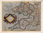
Southwest
England
|
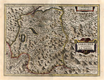
Duchy of
Savoy
|
|
|
|
| 
|
|
|
Marocco,
Canary Islands
|
Tierra del
Fuego
|
|
In the following
a few maps from
an "Atlas
Minor"
(pocket size
atlas) by Johann
Janssonius after
Gerardus Mercator,
engraved by
Abraham Goos
and Pieter van
den Keere, published
in Amsterdam
1628.
All offered
maps are nicely
handcoloured
and -
if not mentioned
otherwise -
in a perfect
condition. All
maps are numbered
at upper right
and matted.
A fine selection:
|
| 
|
|
|
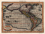
World and
4 continents
|
|
|
|
| 
|
|
|
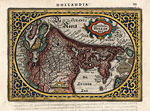
Holland
|
Groningen
|
|
|
|
| 
|
|
|
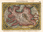
Friesland,
Groningen
|
Utrecht
|
|
|
|
| 
|

|
|
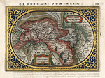
Gelderland
|
Belgium
|
|
|
|
| 
|

|
|
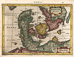
Denmark
|
Iceland
|
|
|
|
| 
|

|
|
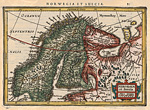
Scandinavia
|
Russia, Belarus,
Ukraine
|
|
|
|
| 
|
|
|
Russia, Belarus,
Ukraine
|
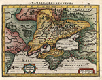
Ukraine,
Crimea peninsula
|
|
|
|
| 
|

|
|
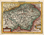
Bohemia
|
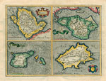
Crete and
other Greek
islands
|
|
|
|
| 
|

|
|
Virginia
/ East Coast
|
Southeast
Asia
|
more
maps after Mercator
by Hondius:
|
| 
|
|
| British
Isles
|
The Netherlands,
Zealand
|
|
|
|
|
|
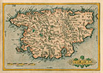
Corsica
|
maps
after Mercator
by Blaeu:
|
|

|
|
|
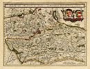
Bavaria
|
Salzburg - Carinthia
|
|
|
|
|
|
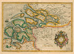
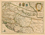
Croatia, Bosnia-Herzegowina,
Serbia
|
|
|
|
Back
to top
|
|
|
|


